Interpretation Center
The approval and development of the Special Plan for Cerro de San Vicente in 1997, together with the subsequent execution of the Project for the Protection Works of the Traces of the Old Convent of San Vicente, led to the construction of a museum space over the cloister of the vanished Benedictine monastery. Likewise, the archaeological excavation of 400 m² of the protohistoric settlement on the upper plateau was carried out for public exhibition, marking the first steps towards the creation of the “Cerro de San Vicente” Interpretation Center in Salamanca.
The projects subsequently developed by the Regional Government of Castile and Leon and the Salamanca City Council have allowed for the definitive enhancement of these spaces, making them accessible and traversable, in addition to designing interpretive materials that facilitate their visit and dissemination. Finally, an exhibition has been installed inside the municipal building constructed over the remains of the cloister of the Convent of San Vicente, which addresses aspects of both the archaeological site itself and the Vía de la Plata.
Currently, a guided tour program organized by the Tourism department of the Salamanca City Council is underway, which allows access to the archaeological remains of the site —both protohistoric and conventual— and to the exhibition housed in the museum.
PROTOHISTORIC REMAINS
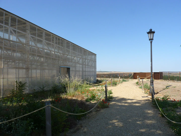
Within a covered structure and from the walkway installed inside, the traces of the city's first inhabitants can be contemplated, in an excellent state of preservation.
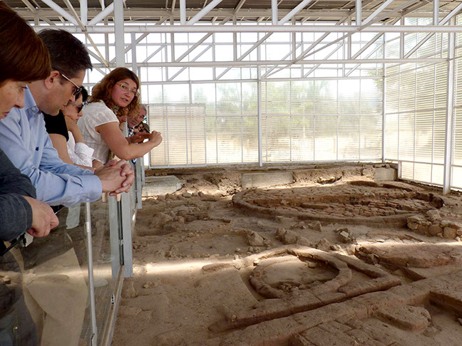
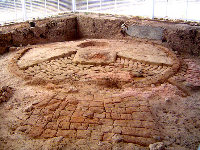
The exposed remains correspond to a part of the settlement established on Cerro de San Vicente during the First Iron Age, between the 7th and 4th centuries BC. Four complete dwellings and up to nine auxiliary domestic structures (silos, pantries, granaries...) linked to the main constructions are shown. These are distributed in two bands aligned around a road or "street", offering a magnificent example of the mud and adobe architecture that characterizes this culture.
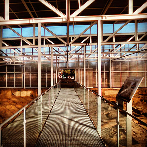
These vestiges are accompanied by a series of panels with information and images that facilitate the understanding of the remains and complement the explanations of the archaeologists who guide the visit.
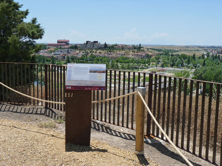
THE VIEWPOINT
To the West: The Tormes
Facing west and above the trace of the Cerca Nueva, a viewpoint has been installed that allows observing the urban expansion of the city in this direction, with the hospitals and the University Campus in the foreground, as well as the surrounding landscape and the Tormes valley.
To the South: The Vía de la Plata
From the viewpoint in the southern area of the hill, we can see the dehesa landscapes of Campo Charro and the access of the Vía de la Plata to the city, crossing the bridge over the Tormes river from Prado del Zurguén. An informative panel has been installed that interprets the space unfolding before our eyes and transmits the history rooted in its surroundings.
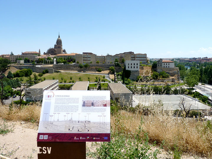
To the East: The Teso de las Catedrales
The privileged and unprecedented perspective that Cerro de San Vicente offers of Salamanca's historic complex becomes one of the site's main attractions, adding to the immense patrimonial value of the enclave. For this reason, a viewpoint has been installed in the southeast of the hill to contemplate the majestic profile of the monumental city over the neighboring Teso de las Catedrales. A panel, with its corresponding explanatory legend, helps identify the architectural landmarks that emerge before our eyes.
EXHIBITION
THE BUILDING
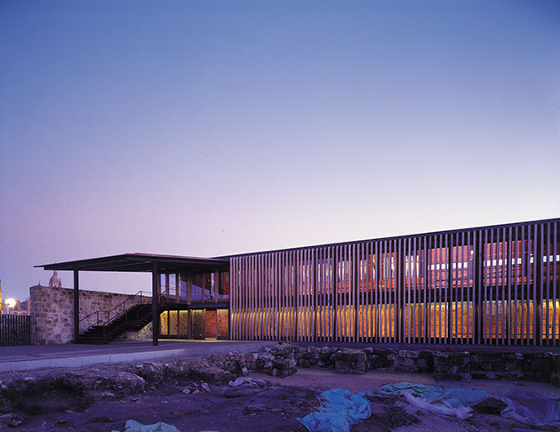
This museum space was designed by architects Juan Vicente, Pablo Núñez, and Pablo Redero, promoted by the Illustrious City Council of Salamanca, and awarded in 2002 with the National Prize for Restoration and Conservation of Cultural Heritage "World Heritage Cities". Its very structure recreates the spaces of the cloister of the old Benedictine convent, whose courtyard is integrated into the complex. The building itself forms an essential part of the exhibition: cellars, floors, walls, buttresses, and other original elements of the convent serve as an unparalleled setting for the content developed in the musealization.
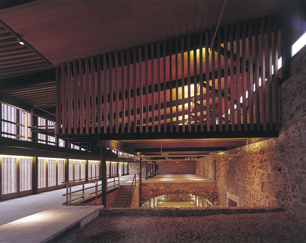
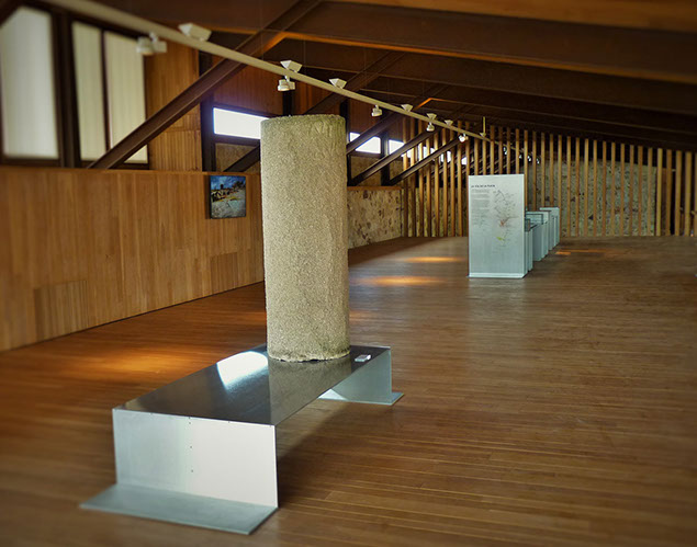
The floor plan is "L"-shaped around the cloister space, coinciding with the original structure of the historic building, and a series of walkways and platforms facilitate the tour inside. There is also an exterior circuit through the perimeter moat, from which one can appreciate the imposing strength of the building's implantation on the hill and the impressive craftsmanship of the structures and buttresses of the Convent of San Vicente. In the museum halls, an exhibition has been installed that focuses on two main thematic areas: the archaeological site of Cerro de San Vicente and the Vía de la Plata.
THE ARCHAEOLOGICAL SITE
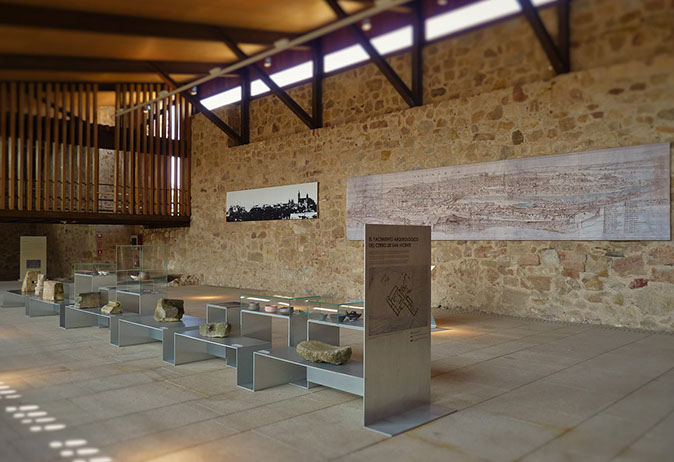
The visit begins from the main entrance with an introductory panel on archaeological research, the urban planning project, and the construction of the building. It continues in the large space of the west wing, with a continuous display case showing the emblematic moments and milestones in the history of the enclave and of Salamanca itself: its origin —represented by the protohistoric settlement—, its rebirth during the Reconquest (Repoblación) —with the pioneering foundation of the San Vicente monastery—, its monumental heyday in the Modern Age —illustrated by the Benedictine convent and college— and its destruction and decline —manifested in local episodes of the War of Independence—.
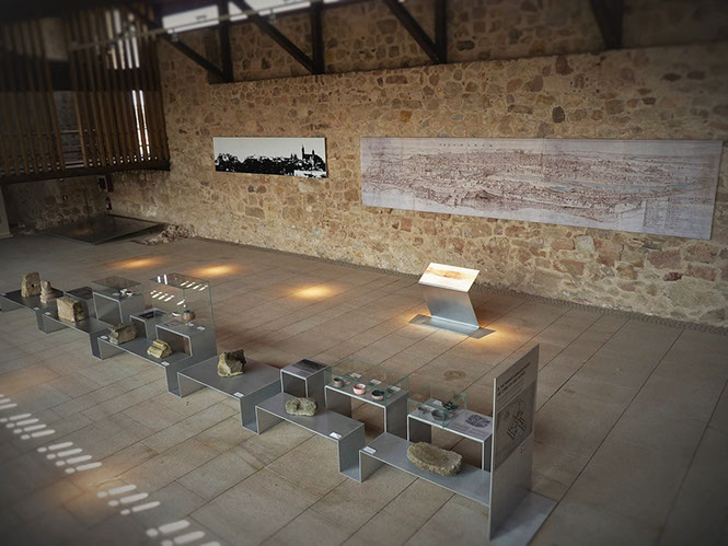
As a backdrop to this room, two large canvases hang from the ceiling: the first reproduces Anton Van den Wyngaerde's famous engraving of Salamanca from 1570; the second is a profile of the city from the south that includes the silhouette of Cerro de San Vicente, traditionally excluded from urban views, and whose inclusion is asserted due to its relevance in the history of Salamanca.
Next, in the southwest corner, the original 16th-century pavement of the western room of the monastery's south wing is exhibited, with information about its origin, discovery, and excavation. From this side, a staircase leads to the original cellars of the building located in the south wing, a space of great plasticity and beauty. At the final point of the tour, in the southeast of this floor, a room is located where a brief audiovisual presentation on the history of the city is projected.
THE VÍA DE LA PLATA
On the upper floor is the exhibition related to the Vía de la Plata, with magnificent views over the neighboring Teso de las Catedrales. The undeniable influence of this route on the historical development of Salamanca has motivated its inclusion in this Interpretation Center.
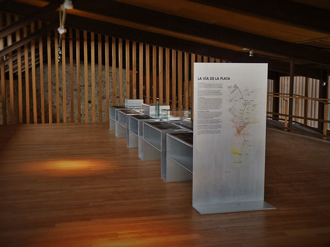
Here, an exhibition sequence on the historical route has been arranged, starting with a replica and description of milestone 158 of the Calzada de la Plata (Silver Way Roman Road) and continuing with a display case, similar to the one installed on the lower floor, in which different aspects of the theme are developed: the origin and history of the route, its passage through the province of Salamanca, Roman Salmantica, the road in ancient sources, the origin of the name, the original layout or its current state and enhancement. A succession of texts, images, maps, and reproductions of archaeological objects contextualizes the city's relationship with the Vía de la Plata and the Roman road, and reveals often-ignored aspects of this unique element of our heritage.
The exhibition on this level is completed with a screen that projects photographs of the road and its surroundings, and a video about its route in Salamanca.